





Check points instead of GCP grids
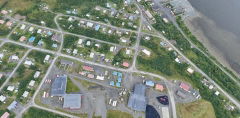
With an RTK fix at 1 cm + 1 ppm, many sites need only a few check points to prove accuracy, not a full grid of ground control.


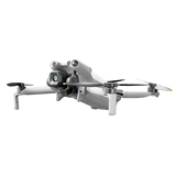
The Matrice 4E is the drone we point survey crews to when they want one aircraft that maps a site in the morning and inspects it in the afternoon. The 20 MP 4/3 wide camera has a mechanical shutter, so mapping photos stay sharp at survey speed, and two 48 MP zoom cameras plus a 1,800 m laser rangefinder take care of the close-up work. Bundles ship with or without a one-year DJI Terra license.
Built for: Land surveyors, construction and engineering firms, mining and aggregates, government mapping teams
49 min flight · 2.8 km² per flight · 15 s to takeoff · 25 km range (FCC)
If the deliverable is a map, a model or a measurement, get the 4E. Its wide camera has a bigger 4/3 sensor and a mechanical shutter, and it shoots faster (0.5 s vs 0.7 s). The 4T trades that for a 48 MP wide camera, a thermal camera and a near-infrared light, which is what search and public safety work needs. The 4E has no thermal camera.
DJI rates 49 minutes in still air with nothing mounted. In the field we tell customers to plan missions around 35–40 minutes so there is always a landing reserve, and less in wind, cold or with a spotlight or speaker on top.
Usually fewer of them. With an RTK fix, a lot of jobs only need a handful of check points to prove accuracy instead of a full GCP grid. If the project has to tie into a local control network or be stamped by a licensed surveyor, follow that project's control spec.
The 4E adds a 70 mm medium zoom camera, a 48 MP tele (up from 12 MP) and a laser rangefinder. It also flies longer (49 min vs 45), reaches farther (25 km vs 15 km video range) and shoots faster (every 0.5 s vs 0.7 s).
DJI's desktop software for turning your photos into maps and 3D models. It exports GeoTIFF, LAS, OBJ, PLY and DXF, and the 4E's images also process fine in Pix4D and Agisoft Metashape.
DJI's AL1 Spotlight and AS1 Speaker plug straight into the accessory port. Third-party payloads built on DJI's Payload SDK, like parachutes and drop systems, fit too.
It weighs more than 250 g, so register it with the FAA. Paid work needs a Part 107 certificate. Remote ID rules apply too, so check your unit's setup before you fly. Government agencies can also fly under a public-aircraft COA.
Yes. We can write a sole-source letter or a side-by-side spec comparison for a grant application. Just ask us. Manuals and release notes are on DJI's download page.


New
Built forSurveying and MappingConstruction PlanningAsset Inspection
| Matrice 4E This drone | Matrice 4T | |
|---|---|---|
| Primary mission | Mapping, surveying, construction, mining | Public safety, search & rescue, utility inspection, firefighting |
| Wide camera (24 mm) | 4/3″ CMOS, 20 MP, f/2.8–f/11, mechanical shutter | 1/1.3″ CMOS, 48 MP, f/1.7 |
| Thermal camera | None | 640×512 radiometric, 1280×1024 with Super Resolution |
| NIR auxiliary light | None | Lights subjects up to 100 m |
| 70 mm + 168 mm tele | 48 MP each | 48 MP each |
| Laser rangefinder | 1,800 m | 1,800 m |
| Min. photo interval | 0.5 s | 0.7 s |
| Ortho capture | 3-direction ortho + 5-direction oblique | 5-direction oblique |
Rule of thumb: if the deliverable is a map, model or measurement, buy the 4E. If the job is finding people, heat or faults, buy the 4T.
With an RTK fix at 1 cm + 1 ppm, many sites need only a few check points to prove accuracy, not a full grid of ground control.
Fly the site, build a surface model in DJI Terra, Pix4D or Metashape, and measure volumes or compare against design grade.
3-direction ortho capture shoots sideways during the ortho pass, cutting lateral overlap without a separate elevation flight.
Spot a problem on the map, then inspect it on the same flight with the 70 mm and 168 mm cameras and measure it with the rangefinder.

Airtime, your kit
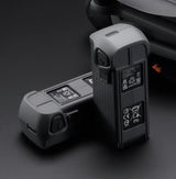
49 Minutes per battery · rated under ideal conditions
01 Power & endurance
The Matrice 4E uses a high-efficiency intelligent battery system designed for extended enterprise operations, delivering up to 49 minutes of maximum flight time under ideal conditions. Advanced battery management provides real-time health monitoring, optimized power usage, and enhanced safety—supporting longer missions with fewer interruptions.
Auto Return-to-Home fires on a reserve charge — it comes back before it dies.
Max transmission distance
02 O4 Enterprise transmission
Equipped with DJI O4 Enterprise transmission, the Matrice 4E delivers a stable, low-latency live feed with strong anti-interference performance. With a maximum transmission range of up to 25 km (FCC), it ensures reliable long-distance control and real-time situational awareness in complex industrial and urban environments.
Lose signal? Advanced Return-to-Home retraces the flight path back to launch — it doesn't fly away.
Sensing coverage
03 Obstacle avoidance
The Matrice 4E features omnidirectional obstacle sensing using a network of vision sensors to provide full environmental awareness around the aircraft. This intelligent system detects obstacles in real time and assists with braking or avoidance, enabling safer low-altitude flight during inspections and mapping missions.
Even great sensors aren't a force field. USDS Care covers accidental damage and crash repairs.
Optics
Optical zoom
Wide · medium tele · tele (mapping) + laser
How much of the wide frame this lens keeps — narrower means more reach.
At that distance the subject fills the frame top to bottom — the drone can hang back this far and still frame the shot.
4/3″ CMOS · 20 MP · f/2.8–f/11 · mechanical shutter
The mapping camera. The mechanical shutter removes rolling-shutter distortion at survey speed. Max photo 5280×3956.
1/1.3″ CMOS · 48 MP · f/2.8
Picks out screws and cracks from about 10 m on power line and bridge work. Max photo 8064×6048.
1/1.5″ CMOS · 48 MP · f/2.8
Reads signs from up to 250 m away. Max photo 8192×6144.
1,800 m range · 600 m at 1:5 oblique
Accuracy ±(0.2 + 0.0015 × D) m, where D is distance in meters. 1 m blind zone.
Max Speed
47 mph / 75.6 km/h
Max Ascent
22.4 mph / 36.0 km/h
Max Descent
17.9 mph / 28.8 km/h
Service Ceiling
19685 ft / 3.73 mi
Max Flight Distance
21.7 Miles / 35 km
Max Flight Time
49 Minutes
Max Hover Time
42 Minutes
Wind Resistance
26.8 mph / 43.1 km/h
Weight
2.7 lb / 1219 g (With Propellers, Battery)
Remote ID
Equipped
| Number of Cameras | |
| Camera System | |
| Zoom | |
| Minimum Focus Distance | |
| ISO Sensitivity Range | |
| Night Vision | |
| Shutter Speed | |
| Maximum Video Resolution | |
| Still Image Support | |
| Photo Modes | |
| Media/Memory Card Slot | |
| Internal Storage |
| Number of Axes | |
| Rotation Range | |
| Follow Speed | |
| Stabilization Accuracy |
| Control Method | |
| Transmission System | |
| Maximum Operating Distance | |
| Transmitter I/O | |
| Clean Video Output | |
| Battery Type | |
| Operating Temperature | |
| Mobile App Compatible | |
| Built-In Display | |
| Dimensions |
| Battery Chemistry | |
| Battery Capacity | |
| Battery Configuration | |
| Maximum Charging Voltage | |
| Charging Temperature | |
| Weight |
| Sensing System | |
| Sensing System Capabilities |
Most in-stock orders ship the same day from our California warehouse. Standard delivery is typically 2–5 business days. If an item is on backorder, we provide clear updates and estimated ship dates.
New units of this model come with a 1-year DJI manufacturer warranty, serviced through DJI's authorized third-party warranty partner.
For extra peace of mind, add USDS Care for protection beyond the manufacturer warranty.
4E imagery also processes in Pix4D and Agisoft Metashape.
Manuals, release notes and the full spec sheet are on DJI's download page. For agency purchases, we can provide a sole-source letter or a spec comparison for grant applications on request.
 DJI RTK-3 Complete Kit
$2,899.99
 300W Matrice 4 Series Four Battery Charging HUB
$299.99
 DJI Propellers for Matrice 4 Series Drones
$49.99
 USDS Care
From $79.99